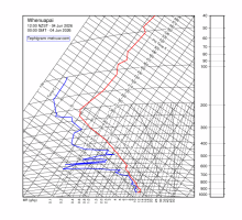
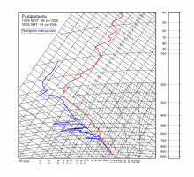
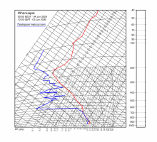
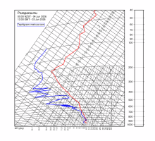
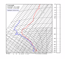
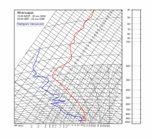
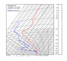
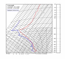
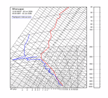
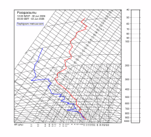
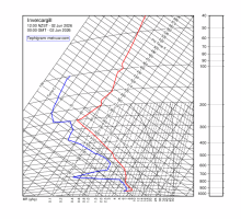
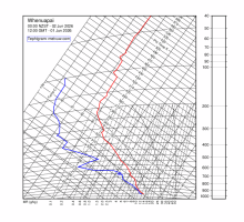
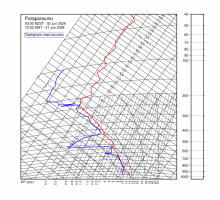
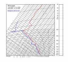
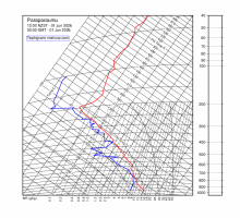
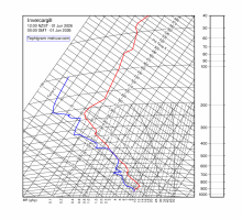
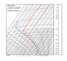
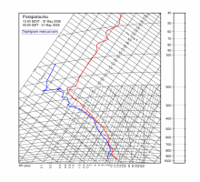
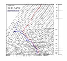
What are these charts?

Radiosondes (weather balloons) measuring upper air temperatures and winds are routinely launched from three stations around New Zealand. These are Whenuapai, Paraparaumu and Invercargill where they are launched at 1100 and 2300 NZT.

The upper air data are displayed on tephigrams. They are updated at approximately 0200-0240 and 1400-1440 NZT. Click on any thumbnail to see the full size version of the tephigram.

The tephigrams are prepared using the Generic Mapping Tools (GMT) package. Comments are welcome.


Whenuapai
Paraparaumu
Invercargill
0000 NZST Thu 17 Apr 2025
1200 NZST Wed 16 Apr 2025
0000 NZST Wed 16 Apr 2025
1200 NZST Tue 15 Apr 2025
0000 NZST Tue 15 Apr 2025
1200 NZST Mon 14 Apr 2025
0000 NZST Mon 14 Apr 2025
Click on thumbnail to display a full-sized image.
Metvuw.com - NZ Weather Site - James McGregor
©Metvuw 2025